This repeater has been decoordinated after multiple inquires to the trustee went unanswered. It was further confirmed off air by our spectrum monitors.
====FASMA RECORD 1198====
Record ID : 1198
Coord Date : 2020-09-25
Update Date : 2016-09-30
Orig Cord Date : 2014-09-25
Holder : Elsa Lecaro, KC4EGP
Trustee : Elsa Lecaro, KC4EGP
URL :
County : Miami-Dade
City : Hialeah
Lat, Lon : 25.83, -80.28
Callsign : KC4EGP
Output Freq : 145.1900 MHz
Input Freq : 144.5900 MHz
Bandwidth : 10.000 KHz
Emission 1 : 11K2F3E
Emission 2 : 7K60FXE
ERP : 90.0 Watts, +49.54 dBm
Antenna Height : 36.58 Meters
Access Tone Out: ERROR: TONE IS UNSET, PLEASE UPDATE RECORD!
Access Tone In : ERROR: TONE IS UNSET, PLEASE UPDATE RECORD!
DMR CC : CC1 = 1, CC2 = 2
Model : https://plots.fasma.org/144/145.1900_KC4EGP_Hialeah_1198.kmz
Service : 24 km
Interference : 63 km
Adjacent 1 : 47 km
Features : o NBFM eE-WIND l(E565618, 442.800, 442375, 145.150, 145.410,
: 145.190, 145.230) rxBiRB DMR 1 CC(1) DMR 1 GC(98518) DMR 2
: CC(2) DMR 2 GC(42423)
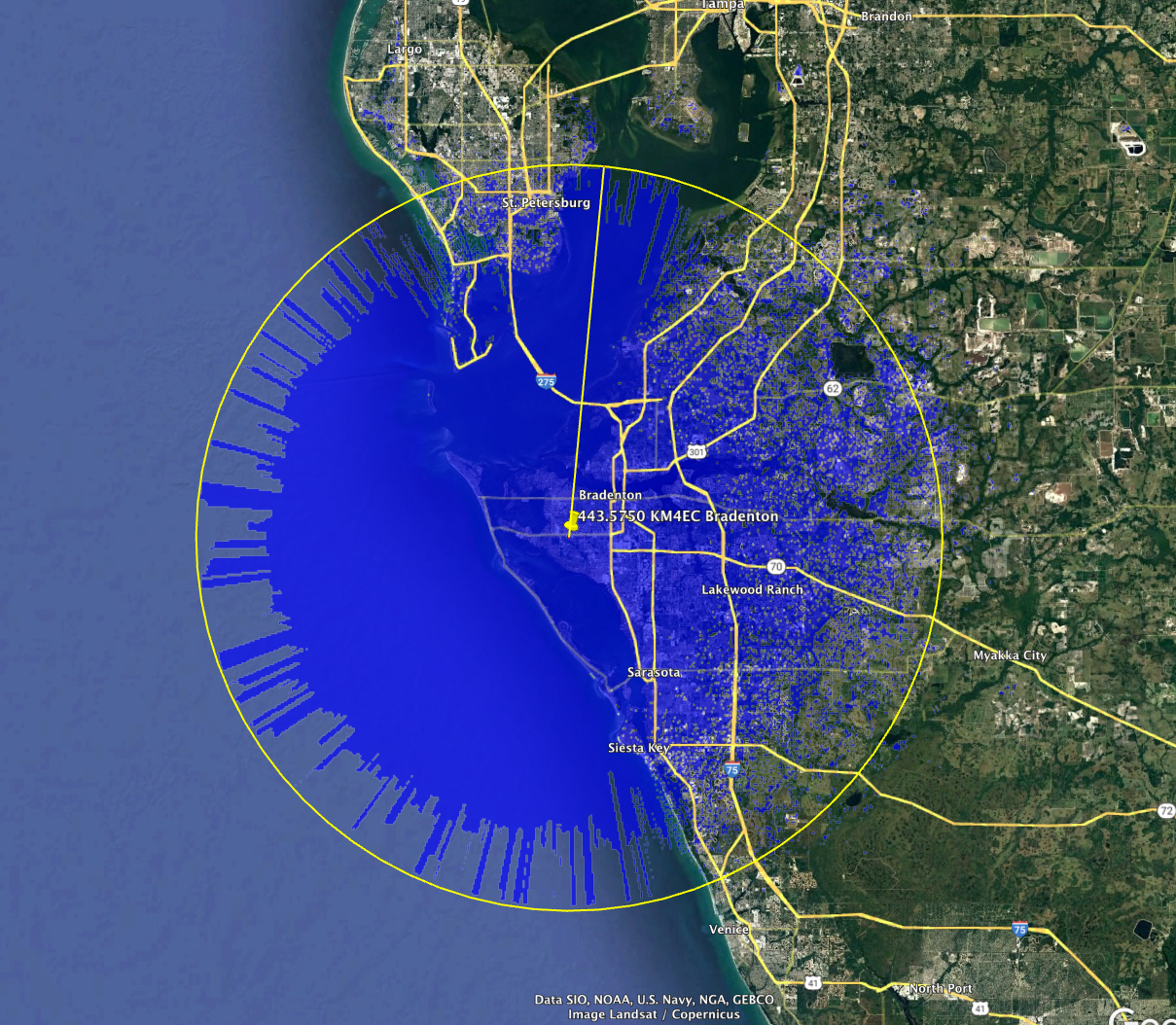
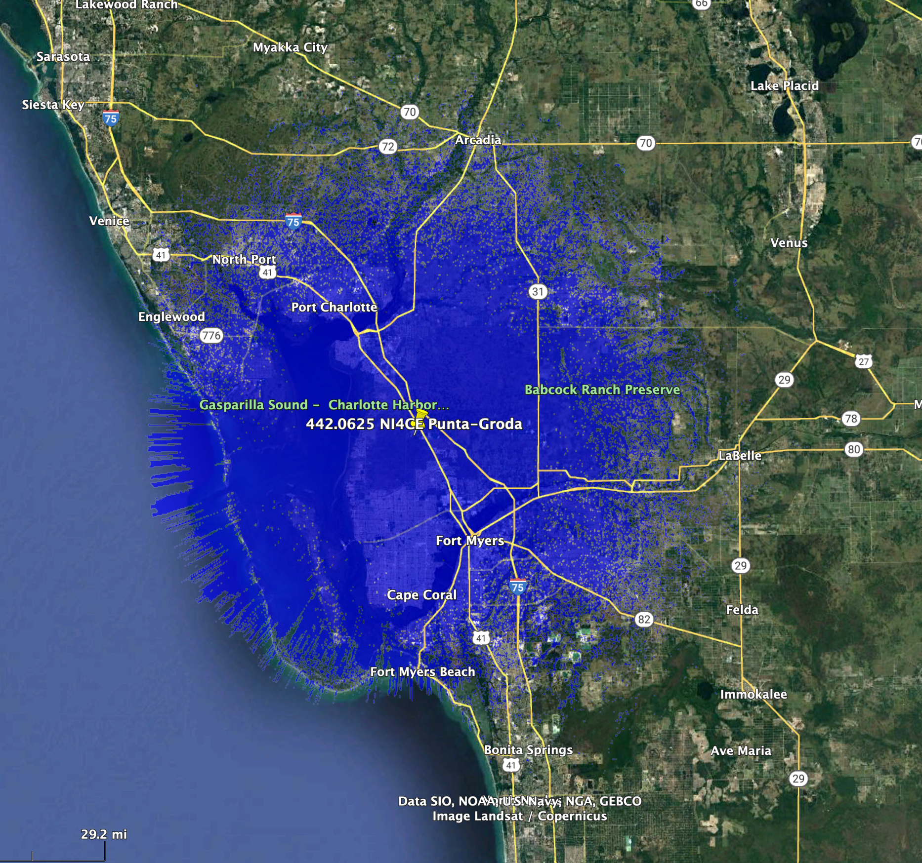
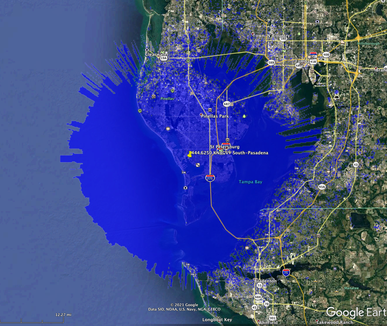
The coverage model is a standard KML format and may be viewed in google earth.
This is automatically generated based on your location, antenna height, ERP and
frequency.
Florida Amateur Spectrum Management Association, Inc.
Home