====FASMA COORDINATION RECORD 3595====
Record ID : 3595
Coord Date : 2021-04-11
Update Date : 2022-03-11
Orig Cord Date : 1997-09-09
Holder : Hog County Amateur Radio Association, Inc
Trustee : Gene E. King, KI4LEH
URL : https://k4hog.org
County : Sumter
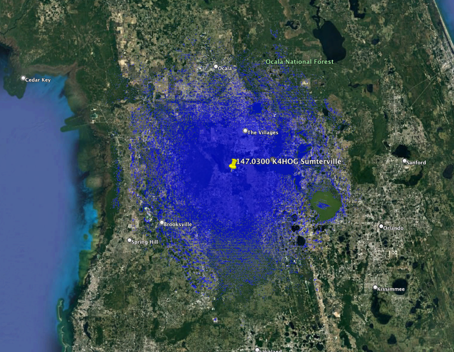
City : Sumterville
Lat, Lon : 28.76, -82.06
Callsign : K4HOG
Output Freq : 147.0300 MHz
Input Freq : 147.6300 MHz
Bandwidth : 15.000 KHz
Emission 1 : 16K0F3E
Emission 2 :
ERP : 130.0 Watts, +51.14 dBm
Antenna Height : 115.80 Meters
Access Tone Out: 123.0 Hz
Access Tone In : 123.0 Hz
Model : https://plots.fasma.org/144/147.0300_K4HOG_Sumterville_3595.kmz
Service : 53 km
Interference : 101 km
Adjacent 1 : 48 km
Features : AllStar: 49829
: Echolink Node: 294541
: Emergency Power
: Weather
: RACES/ARES
: Wide Area
The coverage model is a standard KML format and may be viewed in google earth.
This is automatically generated based on your location, antenna height, ERP and
frequency.